Ann Arbor: Nichols Arboretum Hike

This lovely, 123-acre escape into nature is located on the eastern edge of the University of Michigan’s central campus. Our three-mile hike will take you along the edge of the Huron River and then over winding paths through fields, flowers, woods, and a beautiful valley.
Directions: This hike begins at the Nichols Drive entrance to the Arboretum where, after 5 pm and on weekends, anyone can park for free in the University’s M-29 parking lot. (Before 5 pm on weekdays you will need a university parking sticker.) If the university lot is full, you can park at the nearby hospital parking lots. Put 1500 E. Medical Center Dr. into your GPS. After entering East Medical Center Drive, you will pass the hospital on your right. Keep going, make your first left, and follow the road down to the parking lot. Do not go over the bridge all the way to the 1500 E. Medical Center Dr. building. You are simply using that address to get you to Nichols Drive.
Note: The pictures posted are to help you with directions, since the signage in the Arboretum is quite confusing. The Arboretum is much prettier than the pictures reflect.

Walk to the end of the parking lot, where you will see a sign marking the entrance to the Arboretum. (You will be entering at Marker #8.)
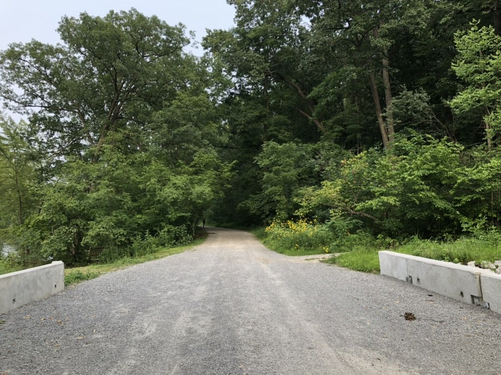
After 0.13 miles, you will cross the bridge shown in the photo. Turn right onto the gravel path just after the bridge. You can see the path in the center-right of the picture.

You will notice stairs at the end of the gravel path. Climb up those stairs and follow the trail.
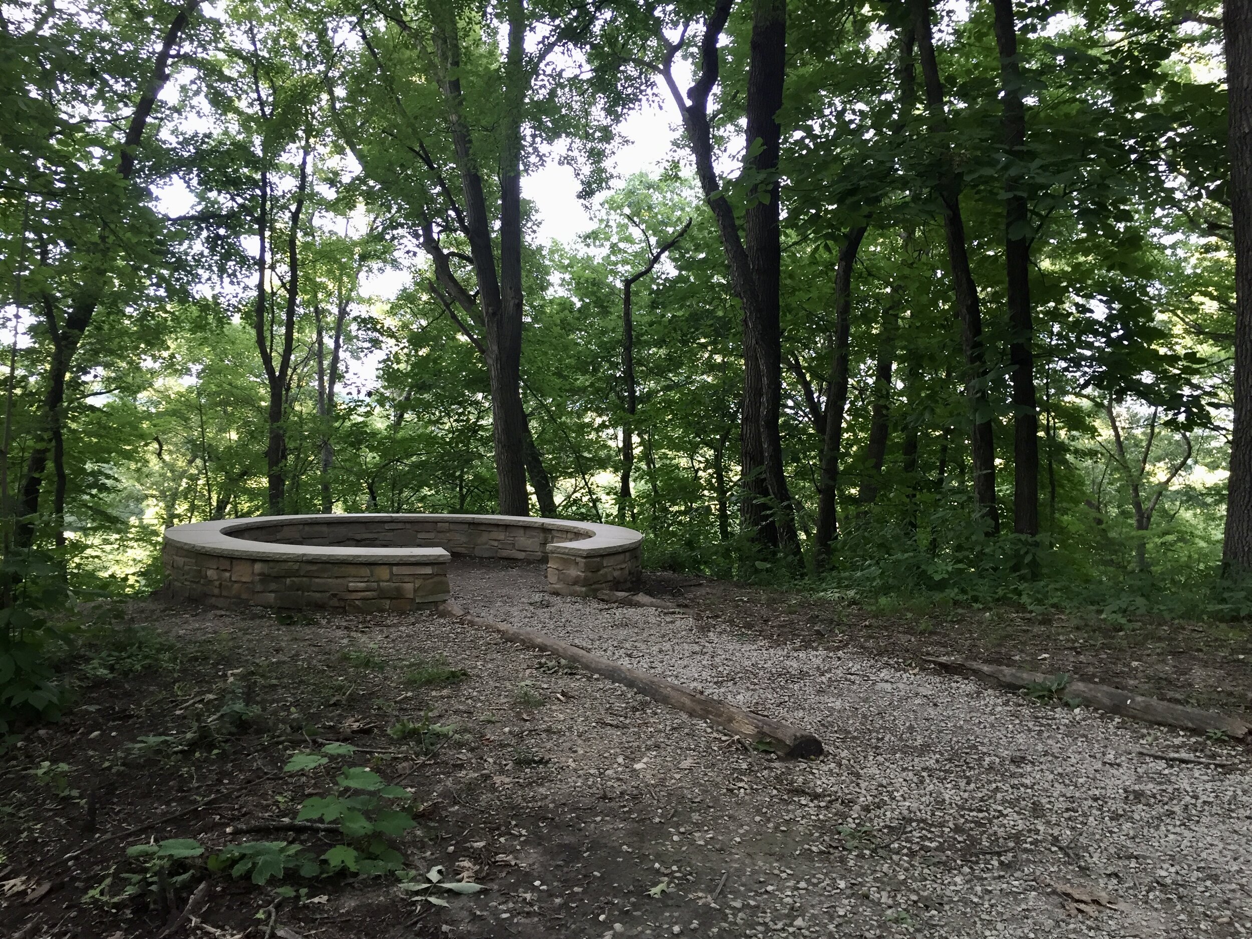
There will be a round, stone overlook on your left. The view of the river is a bit overgrown, but still worth taking a look at. Return to the path. Just ahead, the path will split into a V. Bear right at the V.

The walk starts getting really pretty at this point.

Walk until you see the Reader Center, which is this federal style building on your left. (This is Marker #1.) The visitor center is on the ground floor of the Reader Center and has maps and other information. In front of you is the Washington Heights entrance to the Arboretum. This is where the university’s school of public health is located.

Once back inside the Arboretum, walk back in the direction you came, this time taking the path on the right which will take you through the peony garden and to the area the Arboretum calls Oak Openings, but where the “Fairy Woods and Troll Hollow” area is located in the pine grove on your right. (This is Marker #2.) The sign invites you to build a little home for the fairies and trolls.

Look to see what charming homes people might have built.
At this point you are 0 .7 miles into the hike. At the next intersection, turn right onto the gravel path. As you walk, Fairy Woods and Troll Hollow will be on your right but, soon, the path will turn away from that area. After a bit, you will reach a T in the path and the sign for Marker #3 will be on your left. You’ll see a grass field in front of you in the valley below. Turn right at the T and follow the path through the woods.

The hiking path will bring you to the Deborah Kimbell Memorial Overlook where you will see a pretty view of North campus.

Continue following the path until you reach Marker # 4 which is the Geddes entrance to the Arboretum. Walk up to the gates, but do not exit as the man in the picture is doing. Instead, turn left just in front of the gates onto the small gravel trail. At this point, you have hiked 1.3 miles.
In another 0.2 miles, you will reach Main Valley. This lovely clearing is a popular picnic spot for University of Michigan students. Continue straight on the path. It will seem like you are leaving the Arboretum, but you are not. (Do not turn left here.) Once you exit the woods, you will be at Maker #5. In front of you, you will see a brown building, which is the Arboretum’s Field Office. Turn left.
The Care Taker’s Cottage will be on your left, and the garden will be on your right. You have hiked 1.6 miles. The path will now become more like a wide road.

In another 0.4 miles, you will reach another T. The Huron River will be in front of you. Turn right. As you walk, you will see the large Huron Towers apartment complex on your left across the river.
Turn right at the first intersection. You will see Marker #6 on your right. You have now hiked 2.3 miles. You’ll pass the amphitheater on your right. Keep walking into Dow field. This is a pretty field of tall grass and flowers. If you have had enough, turn around and head back the way you came. When the path ends in a T, turn left. This road will bring you back to the parking lot where you entered and will complete our 3-mile hike. If you want a longer hike, you can hike through, or around, Dow Field.
Text and photos by Irene Daria